Showing posts with label Hike Arizona. Show all posts

Monday, August 29, 2011

Product Review - CRKT Eat'N Tool

So J. comes home one day and says he ordered these gadgets for our camp kitchen from his tool guy? "Ooookay, ummm, so whatja buy", I hesitantly ask..."well, they're these fork things". About a week later he comes home with  handleless sporks. Well, not quite handleless, but enough to make me question it.

The CRKT Eat'n Tool is a high tech, all in one spork/bottle opener/screwdriver/pry tip/metric wrench conveniently hung off a mini carabiner. It's light weight and sturdy, small enough to make the ultralight backpacker happy and ergonomic enough to keep the camping gourmet satisfied.

Once I got used to it I liked it. I wish the spoon bowl was a bit bigger, but I like old fashioned BIG tablespoons for my morning cereal. J. brought home the black safety coated model, it also comes in a dull silver that for Arizona's hot sun I think might be more comfortable. I didn't test it for this, but I do wonder if left in the hot sun would the black be hotter than all get out?

If you are looking to simplify your kitchen rig, I do recommend the CRKT Eat'n Tool. It does everything it is advertised to do and it's kinda sexy, too.


Wednesday, August 10, 2011

Dinosaur Tracks and Ghost Beads

Just west of Tuba City is an old painted sign...Dinosaur Tracks Here. I yelled turn left and we were off on a bumpy dirt road in search of adventure.

Around 600 feet down the road is a row of wooden Navajo ramadas, this day not yet set up when we arrived. We were approached by a soft spoken guide who offered to show us the tracks in exchange for a small donation. Anticipation rising we agreed and set foot on the worn sandstone to see what was created 160 million years ago.
Navajo Ramada, Tuba City, AZ                                                                                                         ©Marcia Mauskopf 2011

This area is a series of soft swells of red sandstone riddled with the prints of Dilophosaurus dinosaur tracks left in antediluvian mud. Camouflaged in the rock, a splash of water from our guide's bottle brought it to life. For you movie buffs. this is the dinosaur we fell in love with in Jurrasic Park, 3 toed lizards up to 20 feet in length and weighing half a ton, a footprint cast in stone only left to delight our imaginations.

Once shown the prints our guide shyly suggested we see the beadwork his wife makes. I was attracted to a string of brown wooden beads interspersed with green glass beads. "Tell me about these" I asked. "well, those are ghost beads...the wooden ones are cedar berries, they purify and protect from evil spirits." As I put my head through the string of beads and adjusted them around my neck I asked why they were called ghost beads. Our new Navajo friend chuckled and said that in the '60's hippies came through the area and hearing the story of the cedar berries proclaimed them Ghost Beads......

Souvenirs of a trip back in time.                                                                                               ©Marcia Mauskopf 2011


This is an easy hike around that is fascinating for young and old alike. Blink and you'll miss it, your opportunity to take a break from the Highway and walk back into ancient time.

Friday, August 5, 2011

Bell Rock Pathway - Sedona, AZ

So, I had a couple of business type things to do in Sedona week before last and really wanted to take a hike in the somewhat cooler temps out of the city.....and it started raining. Going  on the rocks was out, too slippery for my tastes so I thought I'd finally try Bell Rock Pathway, a baby safe route that winds it's way to  Bell Rock or, taking the longer trail, winds it's way around Courthouse Butte for a leisurely 3 1/2 miles.

I drove to the parking lot, a half mile south of Bell Rock just off SR 179 and by then the rain had turned into a refreshingly soft drizzle. Grabbed an ever present trekking pole and I was on my way down the level path.

Hiking Stick or Lightning Rod...you decide.                                 ©Marcia Mauskopf 2011


I was giggling at myself carrying the pole (bum knee and all) when I heard a sudden crash of thunder, look up and laughed "how cool, thunder...thunder!" looked at the metal pole in my hand and panicked "OH CRAP! LIGHTNING ROD!!!" just another Monsoon Day on a Sedona trail.

How to get there:
Take SR 179 to Bell Rock Pathway turnoff in the village of Oak Creek. Good Facilities, paved lot, bathroom, wide graded trail. You will need a Red Rock pass for this lot.

Wednesday, July 20, 2011

A Word About Dehydration

I bet you thought that I was going to remind you [like everyone else does this time of year] to drink your water...Actually, we're talking about the other kind of dehydraton and how very easy it is to do your own stuff for trail and camp.

I got my dehydrator a lifetime ago...I had the mistaken idea that I would save money with it and quickly realized that there isn't a savings over grocery bought dried fruits unless you have trees. But there is a much better reason to drying your own than saving money. Drying your own gives you access to fruit and veggies with no preservatives and saves a ton of space as you will see in the attached photos.

Of course the fruit can be eaten right out of the bag, but no one really tells you how to use fruit and veggies to cook. Here's what I do. Mid day I figure out how much I'm going to need for the dish that I am making, put it in a nalgene and cover with water. check and shake gently every couple of hours to make sure that the water is absorbed and if you need more water in it. If you are hiking the very act of walking will gently agitate. By dinner time your recipe addition will be re-hydrated and ready to cook.


Home dehydrated foods that are properly stored will last 6 months and if frozen a couple of years. Your main danger is mold. Always examine your dehydrated food for mold issues and dispose if it gets hit. Otherwise, Bon Appetit!

Drying can reduce storage size to 1/4 of original packaging.   ©Marcia Mauskopf 2011

#10 cans of peaches are less than $4 at Costco and peas are on sale for as little as 33¢     ©Marcia Mauskopf 2011
You can even dry lemons to flavor your fresh caught trout! This is 11 lemons from my tree. ©Marcia Mauskopf @2011

Sunday, May 29, 2011

Sunday Surfing - Surf Arizona...Seriously

We all like to hike, camp and I think some of us, when the weather here in AZ gets just too hot like to hit the lakes. J. kayaks and I meet the nicest people on the beach...like the 'Brockfish'.

So, I've gotten to know a little bit this guy Chad Brockman...he builds Stand Up Paddleboards...this is some really wicked footage of Chad 'surfing the wave' kicked up by a boat.

GO BROCKFISH!!!!!


Sunday, May 15, 2011

Sunday Surfing - Hiking Food 5000 Calories Per Day.

I thought this was really interesting. Good ideas for packing your backpacking, hiking, camping foods. Found this on a really good blog, Eric the Black's Backpacking Blog. I know when I have time I will be digging through this blog more great stuff ;-)

Sunday, May 1, 2011

Sunday Surfing - Chiricahua National Monument.


Simply Surreal. Anyone been here yet? What was your experience like?

Monday, April 25, 2011

The Grand Canyon and Me, The Changes Over TIme

Out On A Ledge                                                                                      ©2011 Jeff Felske
Some twenty plus years have gone by between my first experience at the Grand Canyon and a spontaneous day trip this Easter weekend. Google maps claimed the drive time as three hours and forty six minutes from my house to the park....a world away from the big city congestion of Phoenix and a universe away from the girl that I was.

I dimly remember the other trip, probably because it just wasn't my thing back then so I didn't file the memories away in that box labeled 'Precious'. I hated the idea of hiking, even walking was labeled "too pedestrian" in my book, and I was merely curious about this big gaping hole labeled one of the World's Great Natural Wonders.

Time changes all and today the parking lot at Mather Point is gigantic, 250 parking spots labeled by animals and numbers a la theme parks, albeit still a short walk to the South Rim Trail. Back then you got out of the car and could almost see the edge from your hood. I remember this because I got out of the car, close enough to be able to see just...how...far...down...it...was, clutched and refused to take even a step farther out of fear. Good enough was a glimpse in real life that showed me less than what the IMAX movie in Tusayan hinted at but hey, saw the movie, got the concept, right?

As the park has improved, so have I. Upgraded changes have smoothed soil and gravel into  handicapped accessible concrete and asphalt trails. Long shallow steps and rails now give safe harbor to even the most fearful. Twenty years of growth has given me a love of the gravel under my feet and fear has been replaced by the innate curiosity to see past the obvious.

As I stood on the edge of the rim balancing in the wind gusts I marveled at the immense grandeur of the scene around me and the fear behind me. The world is a wonderful place as I look 360ยบ around me to appreciate what life has to offer.

Thursday, April 14, 2011

Papago Park West Trails

Ok, I admit it....I haven't been out. I caught the Swine-Asian-Bird-Spanish-Hong Kong flu and after 9 days in bed walking around the block left me breathless. But, the ground was calling me. Enter my friend Charlotte, business coach and owner of Moms With A Passion, who wanted to mix business with pleasure as much as I did.

Trail #5 Papago Park West Trails                                                         ©2011 Marcia Mauskopf

We met at the Elliot Ramada Trailhead, a comfortable place for a picnic or casual meeting, with bike racks, water fountain and covered picnic table. The beauty of Papago Park is that you can have a pleasurable desert hiking experience in the middle of big city Phoenix.

The loop trail here is 2.7 miles, part of a network of trails and service road that crisscrosses the park. The loop takes you along the base of Double Butte, skirts the golf course and gently brings you back again. Along the way we took photos, marveled at the glowing pink ears of a jack rabbit backlit in the morning sun and talked about art and whether we should try one of the butte incline trails (the heart was willing but the lungs not so much). Back at the ramada we shared almonds, talked about life and business, laughing at the cactus wrens and squirrels checking out Charlotte's snack bag. A great morning getting my lungs back in shape and enjoying an oasis in the city.

How To Get There:
Take the 101 Loop to 202 West (Red Mountain Freeway). Exit at Priest Drive. Going  North on Priest which will turn into Galvin Parkway. Turn left on Papago Park Road. This will turn right into the parking lot for Elliot Ramada Trailhead. The trail is just beyond and a service road suitable for wheelchairs is to the right and goes up to Elliot Ramada, located at the base of Double Butte.

Friday, March 11, 2011

Joshua Tree.

Ok, so officially this isn't a hike, I'm not even sure it qualifies as a walk but I wanted to share it anyway.

Highway 93 is the Joshua Tree Scenic Highway, and on this particular day a couple of weeks ago it was stormy....like Snoopy's "It was a dark and stormy night" kind of stormy. Route 93 has pullouts along the road and the couple of times I have done it there is usually a little trail that that you can stretch your legs on and enjoy the patches of Joshua trees. I couldn't take it anymore...the skies were too dramatic and the trees stark against the horizon...I pulled off the pavement, jumped out in the mud and climbed a tiny hill with my camera to find this lone tree. Between raindrops I took 3 shots and it was enough. On to Kingman as the raindrops turned into snow flurries.


 Joshua Tree, Highway 93 North of Wickenberg, AZ           ©Marcia Mauskopf 2011

Monday, January 31, 2011

Where To, Next?

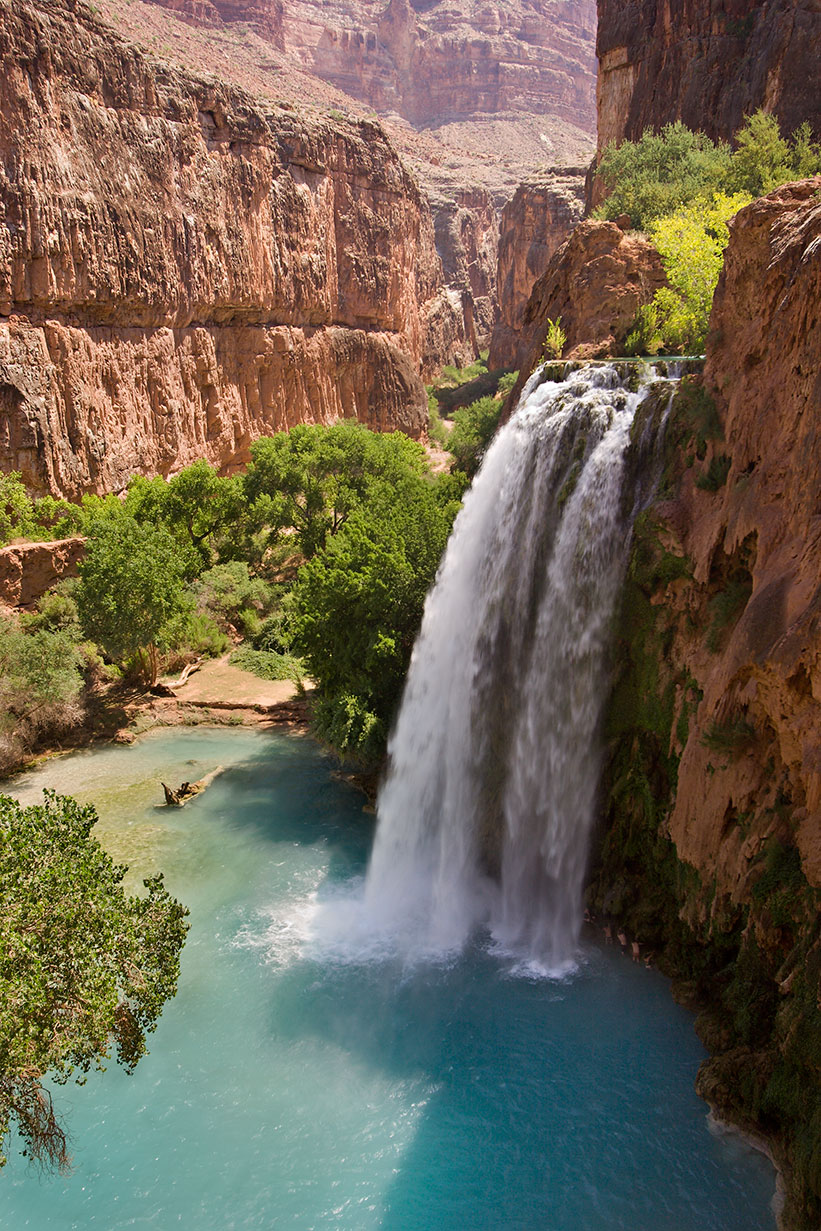
I've decided that I want, no, am going to hike the Grand Canyon. I thought at first about going down Bright Angel Trail to Phantom Ranch and back up to the South Rim, but a conversation with the Guide we hung out with in Sedona last weekend changed my mind....to change the location to Havasupai.

So here's the thing that made me change the location; Bright Angel is about 9 miles down and 9 MILES UP! Havasupai is a little longer, about 12 miles to the bottom and about $85 gets me a ride back up in a helicopter. Talk about Cheap Thrills! Add to this beautiful blue green waters and the chance to see Havasu Falls and Mooney Falls in person, Nirvana, ahhhhh!

I'll have to really train for this. I'm up to about 4 miles now and figure I'll have to add a mile a month to be able to do this hike by next Fall. I'd love to have your help with training tips for this, what will be the longest hike so far.

By User:Moondigger (Own work) [CC-BY-SA-2.5 (www.creativecommons.org/licenses/by-sa/2.5)], via Wikimedia Commons

Sunday, January 23, 2011

To The Summit - Lookout Mountain

 So the day started like any other Saturday, a big breakfast followed by a drive to a trailhead. We chose Lookout Mountain Circumference Trail. 2.3 miles with 180 feet elevation change.

The trail starts with an incline of about 30 feet....cool, I thought, that takes care of a chunk of the elevation change. A short walk from the start is the fork in the road, a split that gives you the choice of circling the park or going straight up to the summit. Coming down the summit trail was a couple with a little white maltipoo. I figured if that cute little thing with his four inch legs could make it to the top then how hard could it be? That theory might have been just a little bit flawed.

A Little Slip and Slide on loose rock never hurt anyone, right?       ©Marcia Mauskopf 2011


It's a little under a mile round trip with an elevation gain of 436 feet. So we decided to go for it and see how far we could get. The trail started as a moderate uphill climb on loose rock, challenging for me but not a complete screamer, just enough to offer a false sense of confidence. It quickly turned into switchbacks that narrowed into small walls negotiated by stepping into cracks and pulling myself up by rocks along the next wall. We eventually made it to the saddle between the two peaks, the lowest point at the top and an incredible view of the surrounding mountains as well as downtown Phoenix. Noticing just one more trail marker that pointed straight up, we looked at each other and agreed, why not, Never tried anything that steep but slow and easy....

Up on my ledge between two peaks.                                                                                               ©Marcia Mauskopf 2011


WTH was I thinking???? The view was spectacular. Looking up I could see my fingers clutching a couple inches of rock and below my toes were hanging on to 3 inches here and there. In between  my knees were doing the Mambo while my mind went a million places, mostly to a short ledge and lots of feet of sharp loose rock below me....did you see the episode of Sarah Palin's Alaska where she gets stuck rock climbing and whines like crazy with a guide above her on a rope? That was me, sans rope.

While I was considering the best way to get down J. was twenty feet above..."hey, do you mind if I go up to the top?" "Yeah, naw, you go ahead, I'll just uh, hang out here.

I finally managed to claw my way down and called my best friend The Backpacker. "Hey, I made it to the top of a mountain!" "Cool, going out"....

Well, maybe not impressive to anyone else, but I'm pretty full of myself. A year ago I would never have left the parking lot to go up a mountain, in fact that first 30 feet or so would have been enough to send me back to a book in the passenger seat...never would I have guessed back then that I would have been hanging by my fingertips yesterday morning.

Tired, but happy.                                                                            ©Jeff Felske 2011


How To Get There
Take Greenway Parkway to 16th Street and drive south to the trailhead. Be aware, that there isn't a lot of parking, no bathrooms and no water so make sure that you are prepared. Dogs are allowed but must be leashed.

Friday, January 21, 2011

Deadman's Pass Trail, Sedona

Why a name like Deadman's Pass? Just Red Rock romance or is there a back story? Turns out there is. According to Jean Matthews Kindig, author of Sedona Area Names & Place, a Native American grave was found in the area....I don't know if that is enough to scare anyone off, but the morning we slipped and slid over this trail there was no one else in sight.

This is a short and easy trail, just right for me at three miles round trip. The morning we went out was after a recent snow, making the trail slick with ice and mud, surrounded by mini snowfields and trickling melt.

Agave and Snow ©Jeff Felske 2011

On this particular morning it was about 40ยบ and so still you could hear the sounds of the occasional bird moving from branch to branch. We set out to where the Boynton Canyon trail intersects with Deadman's and almost immediately started crossing snow. Once on Deadman's Pass we had incredible Red Rock views and the feeling of solitude.

Snow, ice and mud on the trail. ©Jeff Felske 2011


The trail intersects with Long Canyon Trail giving the option of going another six miles round trip. On this day we turned around and headed back to get to the next part of my Birthday adventure, a Mystic Tour....


How To Get There
Take 89A out to Dry Creek Road and go North. Turn left at Long Canyon Rd. then right on FR152C. The trailhead and parking area (with restrooms) are on your right. You will need a Red Rock Pass to park here. If you are going to go to Sedona more than 3 times in a year you'll save by purchasing the $20 Annual Pass.

Tuesday, January 18, 2011

Diary Of A Hiking Virgin

Why is it that the first time you do ANYTHING it's the hardest? I've been blogging for years and years about my photography and can do it in my sleep but writing about hiking???? Well, here goes:

I guess the place to start is by introducing myself and my place in the hiking world. I didn't have one. I was the girl that when everyone else said "let's see what's on the other side of that hill..." I said, " uh, yeahhhhhhh, you go on ahead and I'll just, hmmm, sit in the car and read. I mean, I used to like to go up in the hills a bit back home in Santa Barbara, but breaking a sweat???? Then I moved here...To North Scottsdale and only an hour and a half from magical Sedona, and I got intrigued by the landscape. It started with little walks around Airport Mesa and then one day last year we parked at Bell Rock, I stared at the opening to the trail and took a deep breath....and did it.

...and I never felt more alive.

Deadman's Pass, Sedona AZ
So this is the place that my journey began and my journal begins...I'll be posting about different hikes and camping trips future and past. My experiences with trails, trail foods and equipment. I invite your comments, conversations and tips as I chronicle my little life with bigger and littler hikes.